Geospatial Software
WorkAware | The Future of Geospatial Software Solutions

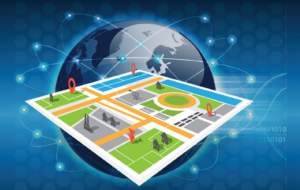
Optimize location intelligence with advanced Geospatial Software. Discover powerful Geospatial Solution tools to analyze data, map insights, and improve business decisions.

Why Geospatial Solutions?
Geospatial solutions help organizations understand and manage location-based data to make smarter decisions. With advanced software and modern geospatial tools, businesses and governments can collect, analyze, and visualize spatial data more effectively. A powerful geospatial platform allows users to monitor operations, identify patterns, and improve planning through accurate geographic insights.
Many geospatial companies now provide innovative geospatial solutions that support industries such as logistics, urban planning, and environmental management.
Advancing Global Development Through Geospatial Software Solutions
 Geospatial technology plays a critical role in addressing global challenges such as urban planning, environmental monitoring, disaster response, and infrastructure development. It empowers organizations by providing powerful geospatial software solutions designed to improve operational efficiency and deliver better outcomes.Through advanced mapping and analytics, our geospatial platform helps organizations visualize patterns, monitor activities in real time, and make strategic decisions based on accurate geographic data.
Key Features
Journey Management
Our geospatial platform supports comprehensive journey management, helping organizations plan routes, monitor field movements, and improve operational efficiency. This feature is especially valuable for logistics, humanitarian programs, and field operations that depend on accurate geographic data.
Geographic Information System (GIS)
Our integrated Geographic Information System provides powerful mapping capabilities that allow organizations to manage, analyze, and visualize spatial data effectively. With advanced software solutions, users can perform detailed geographic analysis and make strategic decisions with confidence.
Location Tracking
Real-time location tracking enables organizations to monitor assets, teams, and operations with precision. Using mobile geospatial software, users can collect and analyze location data directly from the field, ensuring better coordination and improved safety.


Our Expertise
Data Modernization
It helps organizations modernize legacy systems by transforming traditional datasets into scalable, digital spatial frameworks. Using advanced geospatial tools, our team ensures that data is accurate, accessible, and optimized for modern geospatial platforms.
Data Fusion
Our experts specialize in combining multiple data sources, such as satellite imagery, field data, and sensor information into unified geospatial software solutions.
Data Visualization
Turning complex data into clear visual insights is a key strength of geospatial solutions. Our interactive dashboards and mapping systems allow users to interpret geographic information easily.

Why Choose WorkAware Geospatial Solution?
WorkAware is a forward-thinking geospatial company that delivers innovative and scalable geospatial solutions for modern organizations. Our platform combines powerful geospatial solution, advanced analytics, and user-friendly interfaces to help businesses and development organizations unlock the full value of their geographic data.
As a trusted geospatial services company, WorkAware provides a reliable geospatial solution designed to improve data management, streamline operations, and support informed decision-making. Our platform integrates cutting-edge geospatial tools, mobile capabilities, and advanced mapping features to deliver one of the best geospatial software experiences available today.
By choosing WorkAware, organizations gain access to a powerful geospatial platform that enhances productivity, strengthens operational visibility, and drives smarter, data-driven outcomes.
Frequently Asked Questions (FAQs)
What is the Geospatial Platform?
A geospatial platform is a digital system designed to collect, store, analyze, and visualize location-based data. It integrates various geospatial tools and technologies to help organizations manage spatial information effectively. A modern geospatial platform supports mapping, data analysis, and real-time insights through advanced geospatial software solutions.
What are the Geospatial Platform Offerings?
A comprehensive geospatial platform typically offers a wide range of capabilities, including mapping tools, data management systems, and analytics dashboards. These geospatial software solutions allow users to visualize geographic data, track assets, and improve operational planning. Many geospatial software companies also provide mobile geospatial software, enabling field teams to collect and update data directly from mobile devices.
Why is the Geospatial Platform Needed?
Organizations need a geospatial platform to manage and analyze location-based information efficiently. By using modern geospatial software, businesses and government agencies can improve decision-making, optimize resource allocation, and monitor operations in real time. A reliable geospatial solution ensures accurate data insights and better planning.
What are geospatial services?
Geospatial services refer to professional solutions that help organizations collect, analyze, and manage spatial data. These services are typically offered by a geospatial services company and may include mapping, geographic analysis, satellite imagery processing, and system integration using advanced geospatial tools and geospatial software solutions.
What is geospatial data?
Geospatial data is information that describes objects, events, or phenomena with a geographic location. It includes coordinates, maps, satellite images, and other spatial datasets. This data is processed and analyzed using geospatial software and geospatial tools to generate meaningful insights for planning and decision-making.
What is geospatial software?
Geospatial software is specialized technology used to collect, manage, analyze, and visualize geographic data. It is commonly used in industries such as urban planning, logistics, environmental monitoring, and infrastructure management. Many organizations rely on best geospatial software and mobile geospatial software to support field operations and spatial analysis.
What are geospatial information systems?
Geospatial Information Systems (GIS) are computer-based systems designed to capture, store, manage, and analyze spatial data. GIS is a core component of many geospatial software solutions and allows users to visualize geographic information through maps and interactive dashboards on a geospatial platform.
What is geospatial intelligence?
Geospatial intelligence (GEOINT) involves analyzing geographic information to understand patterns, relationships, and trends related to location-based data. Using advanced geospatial tools and geospatial software, organizations can generate insights that support strategic planning, risk assessment, and operational management.
How Will the Geospatial Platform Promote Effective Management of Federal Geospatial Assets?
A well-designed geospatial platform improves the management of federal geospatial assets by providing a centralized environment for storing, sharing, and analyzing spatial data. With the help of modern geospatial software solutions, agencies can streamline collaboration, enhance transparency, and ensure accurate use of geographic data across departments. Platforms developed by leading geospatial software companies help organizations manage resources more effectively and maintain high-quality geospatial data systems.
Start Managing Your Occupational Safety Program Better
WorkAware is a robust safety management software solution designed to streamline your operations and protect you from liabilities. Find out how WorkAware can optimize your business by scheduling a product demo with us.
Empower Your Business with our Digitization Tools and Increase Business Productivity and Bottomline.
See our software in action! Schedule a demo today!
Talk to our 24/7 Customer Service teams:
US Office: 312-761-5423
Canada Office: 647-249-1622
Our team will be glad to answer your queries, concerns, and set a product demo appointment!